Things to Do | Visit Chiba | Latest update:2024/12/27
If you’re looking to spend some time immersed in nature during your next trip to Tokyo, look no further than across the border in Chiba Prefecture! Sitting on the Boso Peninsula, Chiba offers plenty of options to enjoy beautiful mountain scenery, along with views of both Tokyo Bay and the Pacific Ocean. The JR train lines run all around the peninsula, making Chiba an accessible option for some quick day-trip hikes right outside Tokyo. Below are three recommended hikes in Chiba, ranging in difficulty from easy to moderate.
・Level: Easy
・Length: 2.3 km loop
・Access: An 8-minute walk from Ubara Station on the JR Sotobo Line
This spot in the Ubara District of Chiba’s Katsuura City literally goes by the name utopia, or risokyo in Japanese. This coastal area earns such high praise thanks to the natural beauty of its dramatic sea cliffs and cavernous coves. Such scenery is usually found in remote places, but the trailhead here is just a short walk from JR Ubara Station, making it a convenient day-trip destination. Just moments after setting foot off the train, you’ll find yourself immersed in the tranquility and wonder of Chiba’s rugged coastline.
There are no shops or convenient stores between the station and the trail, so it might be best to pack a lunch to bring with you. The Taoyamedaira lookout along the trail makes for the perfect picnic spot. As you walk toward the windswept cliffs here, you’ll see a stone tablet with a haiku inscribed on it. The poet Teijiro Shinoda composed this haiku upon visiting Ubara, and as you look around admiring the sights, it won’t be difficult to imagine how the area inspired him. Walk further toward the praying jizou statue that stands guard in front of the bell tower on the edge of the cliff. Once you’ve ringed the bell and announced your arrival at this sacred spot, take that well deserved rest and enjoy your lunch while listening to the calming sounds of the waves crashing into the sea cliffs that surround you.
・Level: Easy (hike and cable car) / Moderate (hiking only)
・Length: Courses ranging from 1.85km to 3.85km Trail Map
・Access: The trailhead is located about a 10-minute walk from Hamakanaya Station on the JR Uchibo Line, and the Tokyo Bay Ferry terminal
The coastline views and historic sites on offer at Mt. Nokogiri (Nokogiriyama) make it one of the most beloved sightseeing spots in Chiba Prefecture. Mt. Nokogiri originally earned its name, which means “saw mountain,” due to its profile which resembles a Japanese saw. The mountain was used as a stone quarry starting during Japan’s Edo period (1603-1867), which accentuated its already rugged shape by leaving behind dramatic vertical cliff faces that still remain today. Follow the trails along the routes which were once used to bring large stone blocks down the mountain in wooden carts.
From atop the cliffs, visitors can enjoy beautiful vistas of Tokyo Bay and the Pacific Ocean, including a view from the “Glimpse into Hell” lookout spot. The mountain is also home to the 1300-year-old Nihon-ji Temple and its Buddhist cultural sites, including two massive stone monuments.
Learn more by reading the following articles:
Visit Chiba Staff – Mt. Nokogiri Hiking Guide
Mt. Nokogiri – Ropeway Cable Car Course
・Level: Moderate
・Length: 2km round-trip from the trailhead to the summit
・Access: The trailhead is located just behind the Heguri Hub, an outdoor activity complex which serves as a gateway to the southern Chiba area. Learn more here: Heguri Hub website
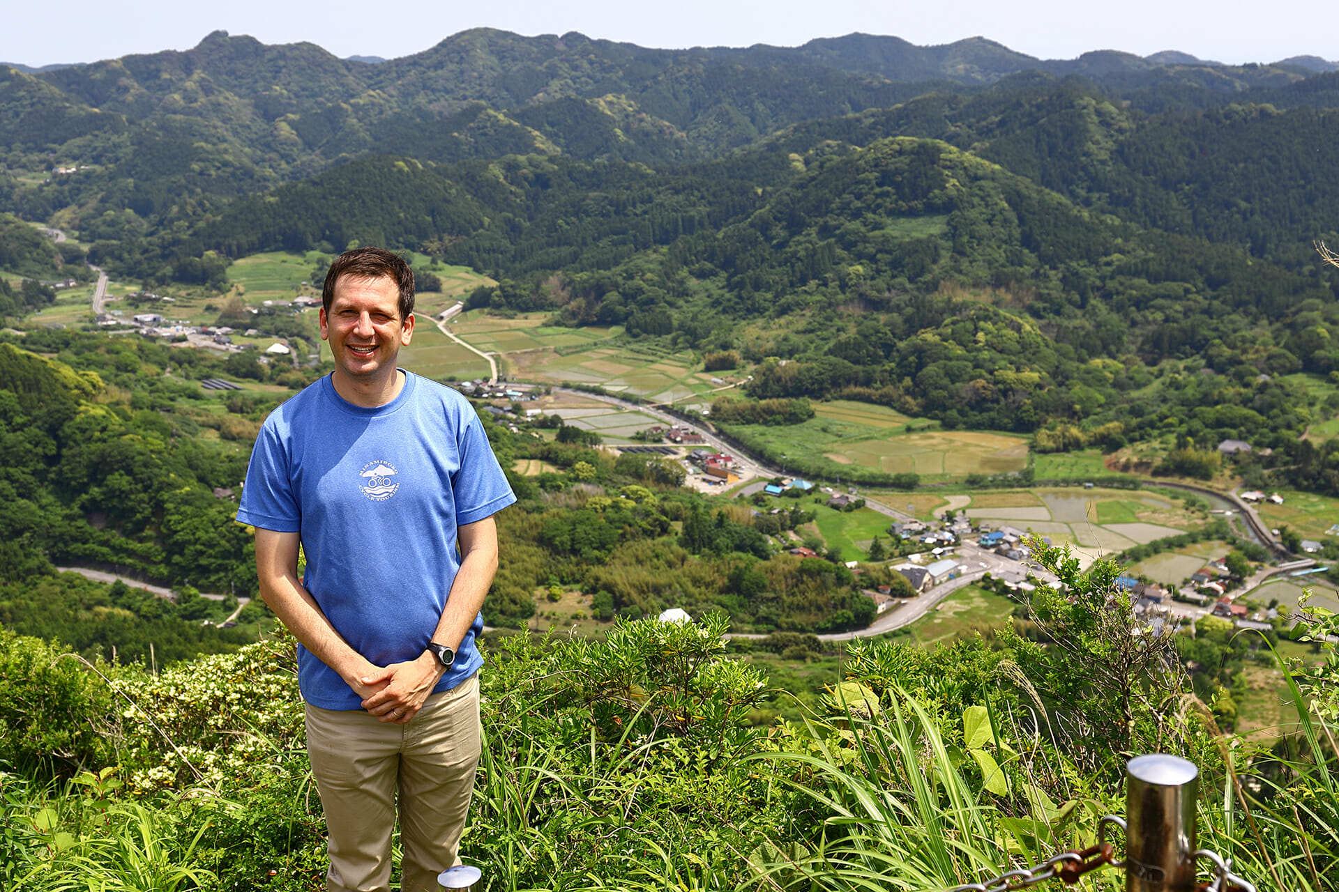
The draw of Mt. Iyogatake is its rocky peak, which offers a stunning 360-degree view of the surrounding southern Chiba countryside. This hike might be short, but the final climb up to this viewpoint at the top of the ‘Boso Matterhorn’ might prove too difficult for some. This last section requires the use of ropes and chains in order to scale the rocky surfaces near the top of the mountain, and wearing durable gloves is recommended.
Before you start your hike, you can pray for a safe climb at the Heguri Ten Shrine just before the trailhead. Just beyond the shrine, you’ll find a signboard which tells the story of the Tengu of Iyogatake. Tengu, (supernatural creatures from Japanese folklore) were known for their mischievous ways, and the Tengu of Iyogatake was no exception. However, there’s no need to fear as the Tengu of Iyogatake lost his powers when he was cleverly tricked by the people of Heguri long ago. Now the only encounters you’ll have here with things otherworldly are the enchanting scenic views of the Chiba countryside.
Ubara, Katsuura City
(An 8-minute walk from Ubara Station on the JR Sotobo Line.)
Nokogiriyama, Kyonanmachi, Awagun
(Mt. Nokogiri Ropeway: About a 10-minute walk from Hamakanaya Station on the JR Uchibo Line or the Tokyo Bay Ferry Terminal at Kanaya Port.)
+81-439-69-2314 (Mt. Nokogiri Ropeway)
Accessibility
238 Hegurinaka, Minamiboso City